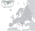
File:Europe-Republic of Kosovo.svg

Size of this PNG preview of this SVG file: 713 × 600 pixels. Other resolutions: 285 × 240 pixels | 571 × 480 pixels | 913 × 768 pixels | 1,218 × 1,024 pixels | 2,435 × 2,048 pixels | 2,045 × 1,720 pixels.
ʻAsi ʻa e faitā auiiki ((Faile SVG, lau pē 2,045 × 1,720 meʻaʻata, ko e faile hono lahi: 7.31 MB))
Hisitōlia ʻo e faile
Lomiʻi ha ʻaho/taimi ki he vakai ʻo e faile naʻe ʻi ai he taimi ko iá.
| ʻAho/Taimi | ʻAtasiʻi | Hono lahi | ʻEtita | Fakamatala | |
|---|---|---|---|---|---|
| taka | 13:15, 17 Tisema 2023 |  | 2,045 × 1,720 (7.31 MB) | Iktsokh | Cyprus geographically in Asia |
| 19:04, 26 ʻOkatopa 2016 |  | 2,045 × 1,720 (7.31 MB) | Giorgi Balakhadze | Rv of sockpuppet and per COM:OVERWRITE | |
| 01:08, 16 Nōvema 2014 |  | 2,045 × 1,720 (7.39 MB) | Leftcry | Reverted to version as of 11:16, 9 September 2014 a map that shows the shadow already exists, you also messed up the visual | |
| 15:33, 25 ʻOkatopa 2014 |  | 1,336 × 1,170 (227 KB) | VS6507 | disputed territory indication shadow | |
| 15:25, 25 ʻOkatopa 2014 |  | 2,570 × 2,250 (2 KB) | VS6507 | disputed territory shadow | |
| 11:16, 9 Sēpitema 2014 |  | 2,045 × 1,720 (7.39 MB) | Rob984 | General improvements | |
| 23:20, 2 Siulai 2013 |  | 2,045 × 1,720 (2.7 MB) | Klodde | User created page with UploadWizard |
Faitā fehokotaki
ʻOku fehokotaki ʻa e ngaahi peesi ki he failé ni:
Global file usage
The following other wikis use this file:
- Usage on af.wikipedia.org
- Usage on als.wikipedia.org
- Usage on ami.wikipedia.org
- Usage on am.wikipedia.org
- Usage on an.wikipedia.org
- Usage on ar.wikipedia.org
- Usage on arz.wikipedia.org
- Usage on ast.wikipedia.org
- Usage on avk.wikipedia.org
- Usage on ay.wikipedia.org
- Usage on azb.wikipedia.org
- Usage on az.wikipedia.org
- Usage on az.wiktionary.org
- Usage on ban.wikipedia.org
- Usage on ba.wikipedia.org
- Usage on be-tarask.wikipedia.org
- Usage on bg.wikipedia.org
- Usage on bh.wikipedia.org
- Usage on bo.wikipedia.org
- Usage on br.wikipedia.org
- Usage on bs.wikipedia.org
- Usage on bxr.wikipedia.org
- Usage on ca.wikipedia.org
- Usage on cdo.wikipedia.org
- Usage on ce.wikipedia.org
- Usage on chr.wikipedia.org
- Usage on ckb.wikipedia.org
- Usage on csb.wikipedia.org
- Usage on cs.wikipedia.org
- Usage on cy.wikipedia.org
- Usage on de.wiktionary.org
- Usage on diq.wikipedia.org
- Usage on el.wikipedia.org
- Usage on en.wikipedia.org
- Usage on en.wikibooks.org
- Usage on en.wikivoyage.org
View more global usage of this file.

