
File:Tahiti and Moorea topographic map.svg

Size of this PNG preview of this SVG file: 800 × 479 pixels. Other resolutions: 320 × 192 pixels | 640 × 383 pixels | 1,024 × 613 pixels | 1,280 × 766 pixels | 2,560 × 1,532 pixels | 1,430 × 856 pixels.
ʻAsi ʻa e faitā auiiki ((Faile SVG, lau pē 1,430 × 856 meʻaʻata, ko e faile hono lahi: 766 KB))
Fakanounou
hhi=sggjbserg
| Fakamahino |
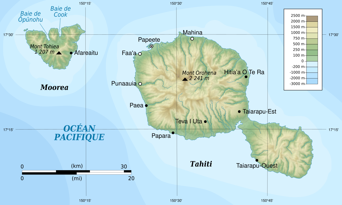
Français : Carte topographique des îles Tahiti et Moorea, Polynésie Française. Projection UTM zone 6S. Rotation horaire de 0,74° pour la géolocalisation (longitudes dirigées vers le nord). |
| Date | |
| Tupunga |
Own work from : English:
Français : |
| Author | Flappiefh |
| Other versions |
|


Laiseni:
I, the copyright holder of this work, hereby publish it under the following license:
This file is licensed under the Creative Commons Attribution-Share Alike 3.0 Unported license.
- You are free:
- to share – to copy, distribute and transmit the work
- to remix – to adapt the work
- Under the following conditions:
- attribution – You must give appropriate credit, provide a link to the license, and indicate if changes were made. You may do so in any reasonable manner, but not in any way that suggests the licensor endorses you or your use.
- share alike – If you remix, transform, or build upon the material, you must distribute your contributions under the same or compatible license as the original.
Hisitōlia ʻo e faile
Lomiʻi ha ʻaho/taimi ki he vakai ʻo e faile naʻe ʻi ai he taimi ko iá.
| ʻAho/Taimi | ʻAtasiʻi | Hono lahi | ʻEtita | Fakamatala | |
|---|---|---|---|---|---|
| taka | 19:07, 30 Sune 2013 | | 1,430 × 856 (766 KB) | Flappiefh | User created page with UploadWizard |
Faitā fehokotaki
ʻOku fehokotaki ʻa e ngaahi peesi ki he failé ni:
Global file usage
The following other wikis use this file:
- Usage on ban.wikipedia.org
- Usage on de.wikivoyage.org
- Usage on fr.wikipedia.org
- Usage on ty.wikipedia.org