
File:Australian Capital Territory parishes.png
Size of this preview: 396 × 599 pixels. Other resolutions: 158 × 240 pixels | 600 × 908 pixels.
ʻAsi ʻa e faitā auiiki ((600 × 908 meʻaʻata, ko e faile hono lahi: 54 KB, faʻahinga MIME: image/png))
Fakanounou
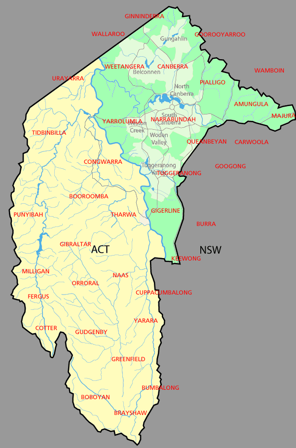
| Fakamahino | Parishes (shown in red) in the area of the Australian Capital Territory. The ones wholly within the ACT are former parishes and do not exist anymore. The land in green was part of Murray County, that in yellow part of Cowley County. (Divided by the Murrumbidgee River) |
| Date | |
| Tupunga | Made from Martyman's GFDL map of the ACT here, using information from the National Library of Australia map here (Map showing proposed Federal Capital Territory and tenures of land within same, 1909) |
| Author | derivative of Martyman's GFDL map |
Laiseni:

|
Permission is granted to copy, distribute and/or modify this document under the terms of the GNU Free Documentation License, Version 1.2 or any later version published by the Free Software Foundation; with no Invariant Sections, no Front-Cover Texts, and no Back-Cover Texts. A copy of the license is included in the section entitled GNU Free Documentation License. |
| This file is licensed under the Creative Commons Attribution-Share Alike 3.0 Unported license. | ||
| ||
| This licensing tag was added to this file as part of the GFDL licensing update. |
Hisitōlia ʻo e faile
Lomiʻi ha ʻaho/taimi ki he vakai ʻo e faile naʻe ʻi ai he taimi ko iá.
| ʻAho/Taimi | ʻAtasiʻi | Hono lahi | ʻEtita | Fakamatala | |
|---|---|---|---|---|---|
| taka | 00:29, 25 ʻAokosi 2007 | | 600 × 908 (54 KB) | Roke~commonswiki | add a few more |
| 09:36, 23 ʻEpeleli 2007 |  | 600 × 908 (150 KB) | Roke~commonswiki | {{Information |Description=Parishes (shown in red) in the area of the Australian Capital Territory. The ones wholly within the ACT are former parishes and do not exist anymore. The land in green was part of [[w:Murray Co |
Faitā fehokotaki
ʻOku fehokotaki ʻa e ngaahi peesi ki he failé ni:
Global file usage
The following other wikis use this file:
- Usage on en.wikipedia.org
- Usage on es.wikipedia.org
- Usage on fr.wikipedia.org
- Usage on hi.wikipedia.org
- Usage on hu.wikipedia.org
- Usage on ja.wikipedia.org
- Usage on kn.wikipedia.org
- Usage on ml.wikipedia.org
- Usage on ms.wikipedia.org
- Usage on pt.wikipedia.org
- Usage on ru.wikipedia.org
- Usage on sd.wikipedia.org
- Usage on simple.wikipedia.org
- Usage on si.wikipedia.org
- Usage on uz.wikipedia.org