
File:CHN orthographic.svg

Size of this PNG preview of this SVG file: 550 × 550 pixels. Other resolutions: 240 × 240 pixels | 480 × 480 pixels | 768 × 768 pixels | 1,024 × 1,024 pixels | 2,048 × 2,048 pixels.
ʻAsi ʻa e faitā auiiki ((Faile SVG, lau pē 550 × 550 meʻaʻata, ko e faile hono lahi: 1.46 MB))
Fakanounou
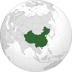
| Fakamahino | China orthographic map |
| Date |
|
| Tupunga |
Own work |
| Author |
Addicted04 |
.svg)
.svg)
.svg)
.svg)
.svg)
.svg)
.svg)
.svg)
.svg)
.svg)
.svg)
.svg)
.svg)
.svg)
.svg)
.svg)
.svg)
.svg)
.svg)
.svg)
.svg)
.svg)
.svg)
.svg)
.svg)
.svg)
.svg)
.svg)
.svg)
.svg)
.svg)
.svg)
.svg)
.svg)
.svg)
.svg)
.svg)
.svg)
.svg)
.svg)
.svg)
.svg)
.svg)
.svg)
.svg)
.svg)
.svg)
.svg)
.svg)
.svg)
.svg)
.svg)
.svg)
.svg)
.svg)
.svg)
.svg)
.svg)
.svg)
.svg)
.svg)
.svg)
.svg)
.svg)
.svg)
.svg)
.svg)
.svg)
.svg)
.svg)
.svg)
.svg)
.svg)
.svg)

.svg)

.svg)

.svg)
.svg)
.svg)
.svg)
.svg)
.svg)
.svg)


.svg)
.svg)
.svg)
.svg)
.svg)
.svg)
.svg)

.svg)
.svg)
.svg)
.svg)
.svg)
.svg)
.svg)
.svg)
.svg)
.svg)

.svg)
.svg)
.svg)
.svg)
.svg)
.svg)
.svg)
_without_national_boundaries.svg)
.svg)
.svg)
.svg)
.svg)
.svg)
.svg)

.svg)
.svg)
.png)
.svg)
.svg)
.svg)
.svg)

.svg)
.svg)
.svg)
.svg)
.svg)
.svg)
.svg)
.svg)
.svg)
.svg)
.svg)

.svg)
.svg)
.svg)
.svg)
.svg)
.svg)
.svg)
.svg)
.svg)

.svg)
.svg)

.svg)
.svg)
.svg)
.svg)
.svg)
.svg)
.svg)
.svg)
.svg)
.svg)
.svg)
.svg)
.svg)
.svg)
.svg)
.svg)
.svg)
.svg)
.svg)
.svg)
.svg)
.svg)
.svg)
.svg)
.svg)
.svg)
.svg)
_-_Crimea_disputed.svg)
.svg)
.svg)
.svg)
.svg)
.svg)
.svg)
.svg)
.svg)
.svg)
.svg)
.svg)
_political.svg)
.svg)
.svg)
.svg)
.svg)
_-_Crimea_disputed_-_no_borders.svg)
.svg)
.svg)
.svg)
.svg)
.svg)
.svg)
.svg)
.svg)
.svg)
.svg)
.svg)

.svg)
.svg)
.svg)

.png)
.svg)
.svg)
.svg)
.svg)
.svg)
.svg)
.svg)
.svg)
.svg)
.svg)
.svg)
.svg)
.svg)
.svg)
.svg)
.svg)
.svg)
.svg)
.svg)
.svg)
.svg)
.svg)
.svg)
.svg)
.svg)
.svg)
.svg)
.svg)
.svg)
.svg)
.svg)
.svg)
.svg)
.svg)
.png)
.svg)
.svg)
.svg)
_(orthographic_projection).png)
| Orthographic projections maps created by Ssolbergj |
|---|
| Orthographic projections maps created by Ssolbergj: |
.svg)
.svg)
| Annotations | This image is annotated: View the annotations at Commons |
Laiseni:
I, the copyright holder of this work, hereby publish it under the following license:
This file is licensed under the Creative Commons Attribution-Share Alike 3.0 Unported license.
- You are free:
- to share – to copy, distribute and transmit the work
- to remix – to adapt the work
- Under the following conditions:
- attribution – You must give appropriate credit, provide a link to the license, and indicate if changes were made. You may do so in any reasonable manner, but not in any way that suggests the licensor endorses you or your use.
- share alike – If you remix, transform, or build upon the material, you must distribute your contributions under the same or compatible license as the original.

|
WARNING! According to Chinese Law, producing, selling and advertising maps or other items, both in electronic and print versions, that do not conform to the territorial claims of the Chinese government is prohibited. |
Hisitōlia ʻo e faile
Lomiʻi ha ʻaho/taimi ki he vakai ʻo e faile naʻe ʻi ai he taimi ko iá.
| ʻAho/Taimi | ʻAtasiʻi | Hono lahi | ʻEtita | Fakamatala | |
|---|---|---|---|---|---|
| taka | 06:04, 11 Fēpueli 2020 | | 550 × 550 (1.46 MB) | 芄蘭 | Reverted to version as of 14:28, 31 July 2019 (UTC) |
| 13:02, 10 Fēpueli 2020 |  | 720 × 722 (334 KB) | Abhishek65628 | Reverted to version as of 15:44, 25 July 2019 (UTC) | |
| 14:28, 31 Siulai 2019 |  | 550 × 550 (1.46 MB) | The Account 1 | Reverted to version as of 22:59, 22 October 2011 (UTC) China still claims Arunachal Pradesh | |
| 15:44, 25 Siulai 2019 |  | 720 × 722 (334 KB) | Lakshmisreekanth | Updated image | |
| 22:59, 22 ʻOkatopa 2011 |  | 550 × 550 (1.46 MB) | Addicted04 | claimed color | |
| 22:03, 22 ʻOkatopa 2011 |  | 550 × 550 (1.46 MB) | Addicted04 |
Faitā fehokotaki
ʻOku fehokotaki ʻa e ngaahi peesi ki he failé ni:
Global file usage
The following other wikis use this file:
- Usage on am.wikipedia.org
- Usage on ar.wikipedia.org
- الصين
- مستخدم:جار الله/قائمة صور مقالات العلاقات الثنائية
- العلاقات الأنغولية الصينية
- العلاقات الصينية الكورية الجنوبية
- العلاقات الصينية الإريترية
- العلاقات الصينية السويسرية
- العلاقات الألمانية الصينية
- العلاقات الصينية الليختنشتانية
- العلاقات الصينية البوليفية
- العلاقات الصينية الموزمبيقية
- العلاقات الصينية البلجيكية
- العلاقات الصينية الإثيوبية
- العلاقات الصينية البيلاروسية
- العلاقات الصينية الطاجيكية
- العلاقات الصينية الروسية منذ عام 1991
- العلاقات الصينية الرومانية
- العلاقات الأرجنتينية الصينية
- العلاقات الصينية الغامبية
- العلاقات الصينية القبرصية
- العلاقات الصينية السيراليونية
- العلاقات الصينية النيبالية
- العلاقات الصينية الليبيرية
- العلاقات التشيكية الصينية
- العلاقات الصينية الميانمارية
- العلاقات الصينية الزيمبابوية
- العلاقات الصينية البالاوية
- العلاقات الصينية المالية
- العلاقات الصينية النيجيرية
- العلاقات الصينية الفانواتية
- العلاقات الصينية الغابونية
- العلاقات الصينية البنمية
- العلاقات الصينية الكوبية
- العلاقات الصينية الجورجية
- العلاقات التونسية الصينية
- العلاقات الصينية الهندية
- العلاقات الصينية الإيطالية
- العلاقات الصينية الناوروية
- العلاقات الأسترالية الصينية
- العلاقات الزامبية الصينية
- العلاقات الصينية الفيجية
- العلاقات الصينية المارشالية
- العلاقات الأذربيجانية الصينية
- العلاقات الصينية الكونغوية
- العلاقات الصينية الدومينيكانية
- العلاقات البرازيلية الصينية
- العلاقات الصينية الغرينادية
- العلاقات الصينية الكازاخستانية
- العلاقات الصينية الكوستاريكية
- العلاقات الصينية الصربية
View more global usage of this file.