
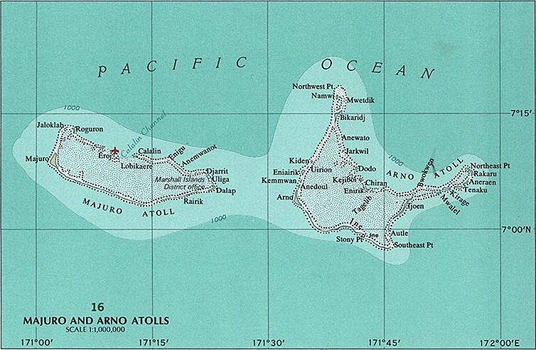
File:Majuro and Arno Atolls.jpg
ʻOku ʻikai ʻi ai ha faitā auiiki.
Majuro_and_Arno_Atolls.jpg ((754 × 493 meʻaʻata, ko e faile hono lahi: 166 KB, faʻahinga MIME: image/jpeg))
Fakanounou
| Fakamahino |
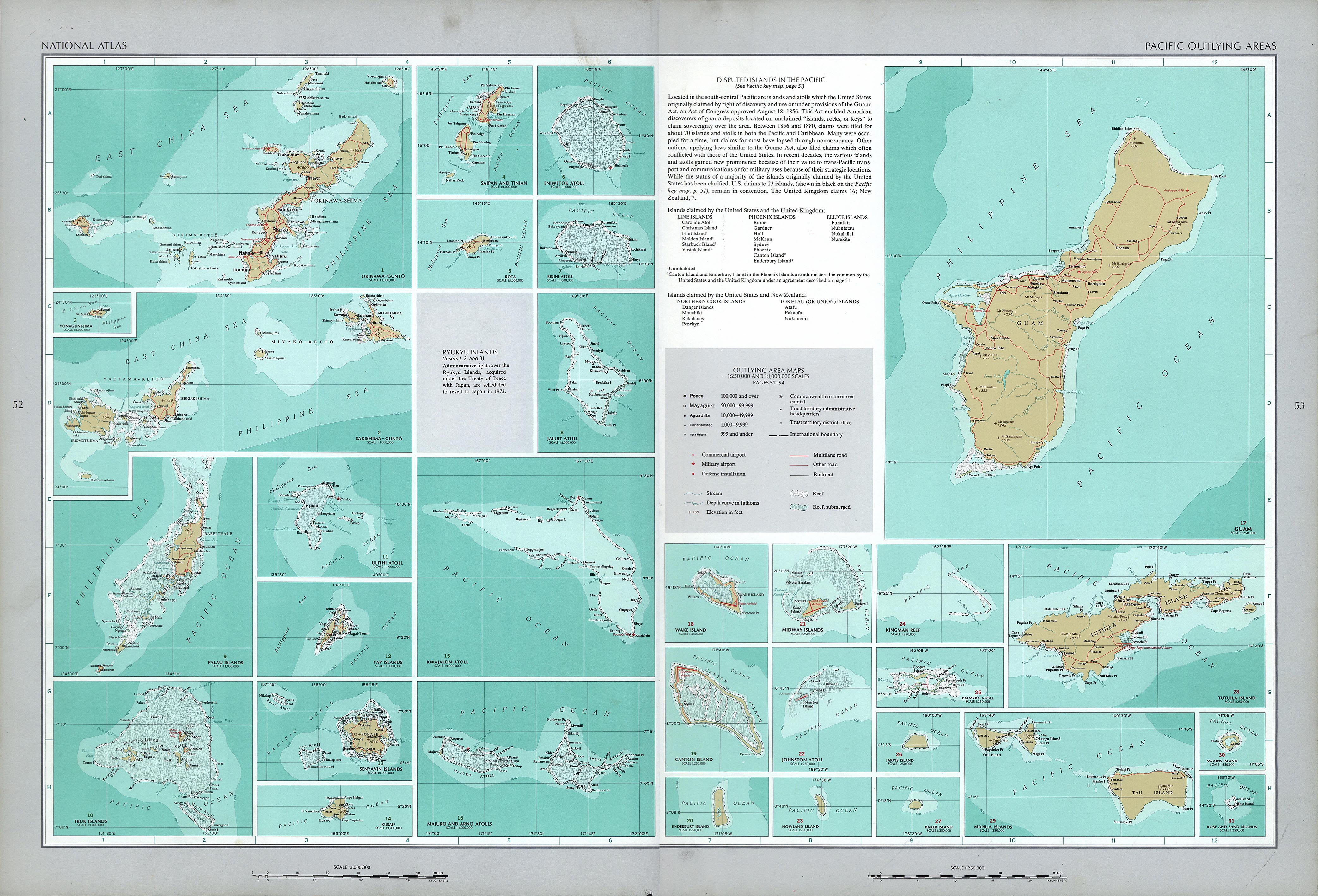
English: National Atlas of the United States, page "Pacific Outlying Areas", with map insets:
|
| Date | |
| Tupunga | https://www.lib.utexas.edu/maps/national_atlas_1970/ca000040.jpg |
| Author | United States Department of the Interior |
| Other versions |

Laiseni:
This work is in the public domain in the United States because it is a work prepared by an officer or employee of the United States Government as part of that person’s official duties under the terms of Title 17, Chapter 1, Section 105 of the US Code.
Note: This only applies to original works of the Federal Government and not to the work of any individual U.S. state, territory, commonwealth, county, municipality, or any other subdivision. This template also does not apply to postage stamp designs published by the United States Postal Service since 1978. (See § 313.6(C)(1) of Compendium of U.S. Copyright Office Practices). It also does not apply to certain US coins; see The US Mint Terms of Use.
|
 | |
| This file has been identified as being free of known restrictions under copyright law, including all related and neighboring rights. | ||
Hisitōlia ʻo e faile
Lomiʻi ha ʻaho/taimi ki he vakai ʻo e faile naʻe ʻi ai he taimi ko iá.
| ʻAho/Taimi | ʻAtasiʻi | Hono lahi | ʻEtita | Fakamatala | |
|---|---|---|---|---|---|
| taka | 09:51, 17 ʻOkatopa 2016 | | 754 × 493 (166 KB) | Mauerquadrant | Cropped 6 % horizontally and 6 % vertically using CropTool with precise mode. |
| 09:50, 17 ʻOkatopa 2016 |  | 803 × 527 (176 KB) | Mauerquadrant | File:National Atlas of the USA 1970 - Pacific Outlying Areas.jpg cropped 81 % horizontally and 81 % vertically using CropTool with precise mode. |
Faitā fehokotaki
ʻOku fehokotaki ʻa e ngaahi peesi ki he failé ni:
Global file usage
The following other wikis use this file:
- Usage on ar.wikipedia.org
- Usage on de.wikipedia.org
- Usage on de.wikivoyage.org
- Usage on en.wikipedia.org
- Usage on es.wikipedia.org
- Usage on ru.wikipedia.org